New Mars Forums
You are not logged in.
- Topics: Active | Unanswered
Announcement
#76 Re: Pictures of Mars » Real images of Mars » 2013-07-18 13:55:24
Phobos from ESA....
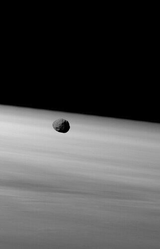
atmosphere by dfrank39, on Flickr
#77 Re: Pictures of Mars » Real images of Mars » 2013-07-18 13:35:32
#79 Re: Pictures of Mars » Real images of Mars » 2013-07-18 13:21:27
Cyclops seems to have "bowed" to UMSF (unmanned space flight) Dough don't want nobody like me. Good news. Flickr gave me a free gig....
Phobos after sunset on Mars.... from Spirit.....
phobos_sol682B by dfrank39, on Flickr
#80 Re: Water on Mars » Mars Weather, Geology, for Real » 2013-07-18 13:10:32
How do I know it is water ice? Because it disappears in a season. Believe it or not, CO2 ice can be buried and can be residual...
Vincent
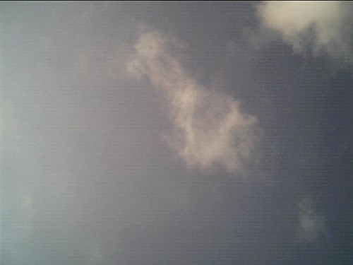
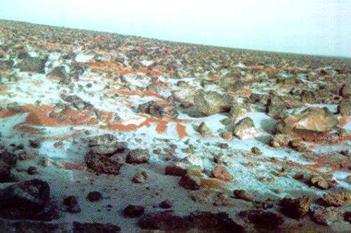
Cyclonic storms do develop in "ideal" conditions on Mars. Surface water snow can and does reach the surface on occasion. This MOC image does show, or give a visible presentation of residual water snow in the late spring...
snow storm by dfrank39, on Flickr
Viking saw it on the surface....
#82 Re: Pictures of Mars » Real images of Mars » 2013-07-18 12:50:15
This Phobos image in Gale, by Curiosity, is witness....
0045MR0209002000E1_DXXX11111 by dfrank39, on Flickr
Vincent
#83 Re: Pictures of Mars » Real images of Mars » 2013-07-18 12:45:27
A repost from Curiosity.....
0333MH0305000000C0_DXXX by dfrank39, on Flickr
#84 Re: Pictures of Mars » Real images of Mars » 2013-07-18 12:41:14
I am relearning how to post images. Mars weather involves water. This image is significant on many levels. First, it shows the image quality that NASA has. Second, it shows the difference in atmospheric dust at different latitudes. Mars can have "dust free" skies as evident here. The "green" skies of Mars are becoming evident. Viking seen, Curiosity did as well. Blue plus yellow equals green. Only in dust free conditions would we see a blue hue.
NASA satellite image:
672847main_vasavada-4_full by dfrank39, on Flickr
Viking "raw" image of the sky:
Mars_Viking_11h016 by dfrank39, on Flickr
Curiosity image of the sky:
Sol45_Mastcam100_MountSharp by dfrank39, on Flickr
Dust conditions dictate sky conditions. Mars may not have "little green men," but it has, "green' skies..."
Vincent
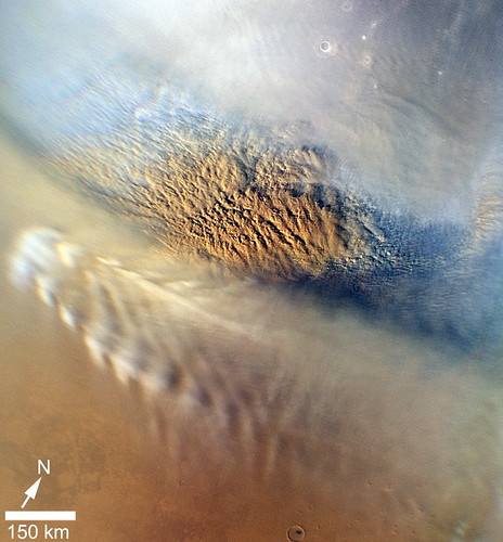
#85 Re: Pictures of Mars » Real images of Mars » 2013-07-18 11:48:19
This is the ESA image. It shows the water rich region. The impact regions are very smooth as melt water flows and refreezes. It looks like frozen mud, because it is frozen mud. The surface water is not far below the dusty surface. These "lakes" formed, not long ago in geological time.
ESA reference link:
http://www.esa.int/Our_Activities/Space … south_pole
Image:
Springtime_at_Mars_south_pole by dfrank39, on Flickr
#86 Re: Pictures of Mars » Real images of Mars » 2013-07-18 11:27:36
The "lake" image is representative. The question is only, How old? The lost likely source is ground water and or melt water. Melt water is most likely, from impact heat. The ESA did publish a south polar image that shows a history of floods post impact.
I will post it if I can find it before I drift off.....
This image was taken in the last few sol's by the hand imager. It is a "raw or natural color" image previously called "true color." A characteristic of natural color is, well, it looks natural... It does not negate the Viking images that were taken in a less atmospheric dusty mid latitude. This site is closer to the southern highlands, the primary source of erosional dust on Mars. I love it when things make sense....
Vincent
0333MH0305000000C0_DXXX by dfrank39, on Flickr
#87 Re: Not So Free Chat » Randy Travis » 2013-07-11 10:42:41
#88 Not So Free Chat » Randy Travis » 2013-07-11 10:28:24
- Vincent
- Replies: 1
Now does alcoholism kill?
You bet your ass. Does it try to kill me, Yep? For my brother Randy.
I have been embarrassed no doubt to his degree, not yet.
I have not yet been in a convince store naked, but I feel nobody loves me, no doubt....
For my brother:
#89 Re: Water on Mars » Mars Weather, Geology, for Real » 2013-07-11 09:53:17
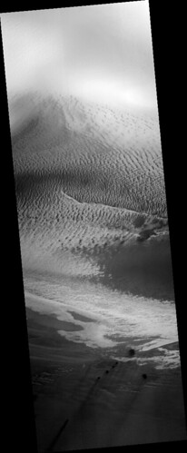
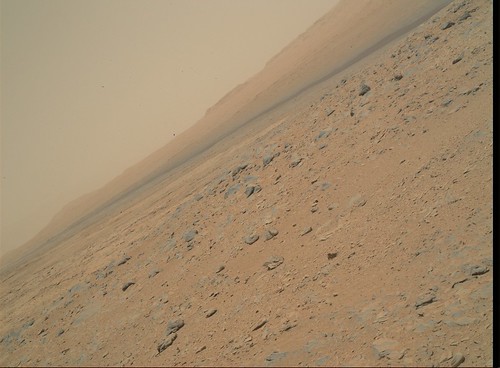
As far as surface conditions I present the current Gale Crater images. It shows rocks and dust, as it should.
Curiosity Sol 329:
0329MR1334000000E1_DXXX by dfrank39, on Flickr
Miridiani Sol 120 or about:
sol 122 by dfrank39, on Flickr
Can you tell the difference?
The bottom line is an impact region, vs. a natural deposition area with outgassing....
Vincent
#90 Re: Water on Mars » Mars Weather, Geology, for Real » 2013-07-11 09:33:34
The next discussion is about water influence. Now, any reasonable mind would proclaim that without a renewed source of water, then, all water would be frozen and buried in dust. If this sounds reasonable, it is because, it is reasonable.
So where is the water coming from? Out gassing.
So the visible evidence should present a dust covered Mars, that it doesn't, or, the visible evidence should present both a renewed ice layer and out gassing.
The "fact" that new ice forms at the poles each winter is without question. Without renewal, this would end. The orbital satellites show, not only the current water interaction, but, out gassing evidence.
Current water vapor interaction. Orographic lift occurs as upslope conditions develop. Earth analog is along the front range of the Rocky Mountains in the U.S.
This image shows orographic lift and layered development of a visible accumulation of water vapor. This is logical, not only in physical development, but in visible presentation.
Source:
2002_06_18_24 by dfrank39, on Flickr
Cropped, magnified and rotated:

2600837350_752bfdc47d_o by dfrank39, on Flickr
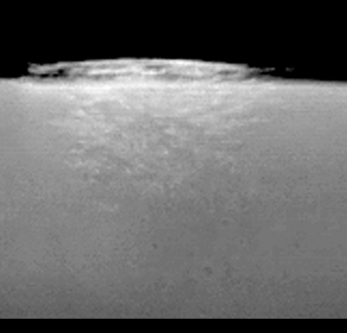
This image, high ice cloud over Mars' limb. This composite of red and blue Mars Global Surveyor (MGS) Mars Orbiter Camera (MOC) images acquired on 6 July 2005 shows an isolated water ice cloud extending more than 30 kilometers (more than 18 miles) above the Martian surface.
That was posted long time ago The visible presentation is different, because there is a difference. It is a plume at the base of a volcano. The visible presentation is different, because the source is different. We have seen orographic atmospheric water vapor moisture in a satellite visible presentation. This is water vapor out gassing....
Can you tell the difference?
#91 Re: Water on Mars » Mars Weather, Geology, for Real » 2013-07-11 08:46:35
To understand the color editing and image quality restrictions for public consumption by NASA, I present one more image. This image was presented by NASA just before Curiosity landed. Have you ever seen such a detailed "true color" image from Mars before? They got'em.
My link:
672847main_vasavada-4_full by dfrank39, on Flickr
#92 Water on Mars » Mars Weather, Geology, for Real » 2013-07-11 08:32:35
- Vincent
- Replies: 14
Just looking over some images and "believe" I can make some reasonable arguments for dynamic Mars weather, geological events occurring now on Mars. These go against the mainstream but are not without evidence by current probes. I am not a geologist, but out gassing is a result of subterranean events. Evidence of these will be presented with surface and orbital observation.
The low pressures on mars do develop air masses and areas of divergence, subsidence, convergence and convection. The hydro cycle is always involved, Sublimation and cooling and condensational latent heat drives a thermal gradient wind. Earth analogs are rare but do and can occur.
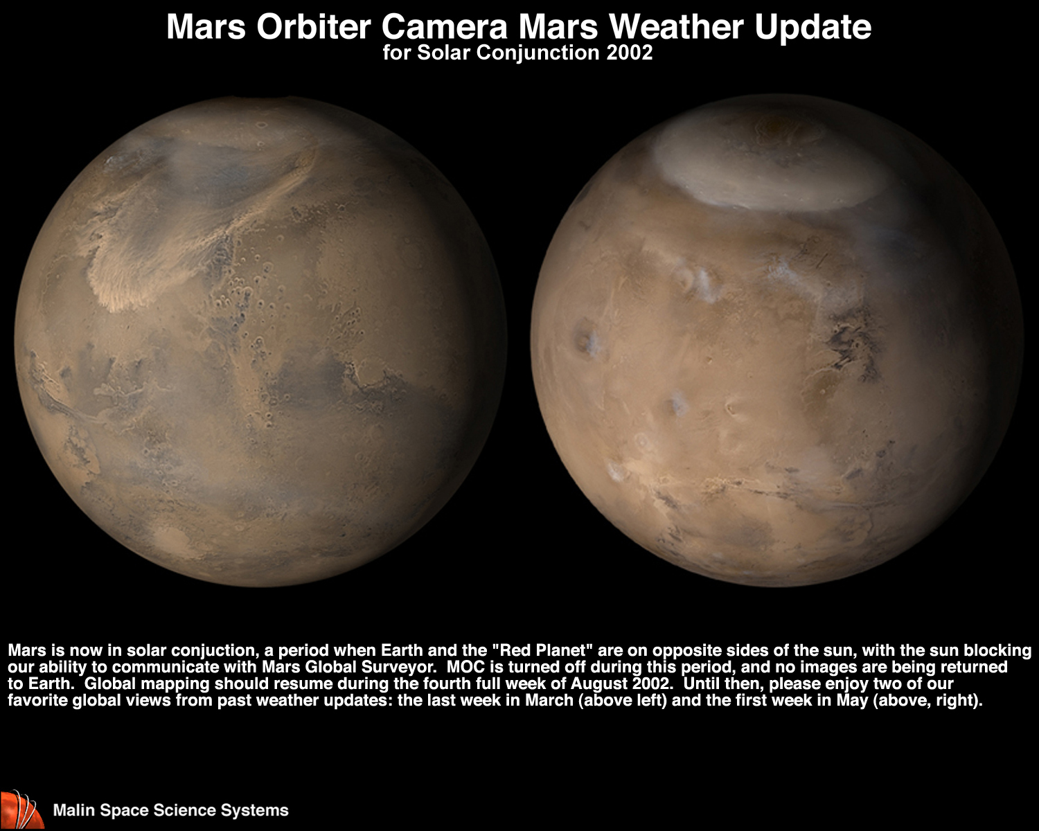
The first link is from with Mars Global Surveyor. A cropped image from this link:
http://www.msss.com/mars_images/moc/wea … tion02.jpg
This link is a crop:
http://www.flickr.com/photos/11627092@N06/9263003700/
This is a surface analysis of the above crop. This looks like an Earth weather map, but it showed be understood that pressure differences are small, but are present. The dynamics or winds, are thermal with only a small pressure gradient influence.
This image is significant because of air mass migration and atmospheric mixing southward to near 10 degrees latitude No water vapor is condensed to the point of visible accumulation. Keep in mind this image was taken in 2002 when visible color was either questioned and often edited to adhere to current theory. That being said, the dynamics cannot be denied, no matter the visible color depiction.
http://www.flickr.com/photos/11627092@N06/9263008448/
More to come....
#93 Not So Free Chat » Titan » 2013-07-05 09:46:42
- Vincent
- Replies: 6
This is the best processed image of Huygens data as the probe entered the atmosphere. I suspect it is "white balanced." Why can't the just take the damn picture ????
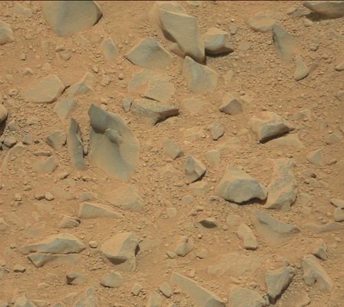
#94 Re: Unmanned probes » Official MSL / Curiosity Rover Thread | Aug 5, 2012 10:31 p.m. PT » 2013-07-05 09:34:02
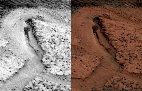
I think we should produce at least one fossil from Miridiani. This is a berry on a stem. If you notice at the Curiosity site, that the concretions are irregular, as they should be. The berries are perfect sphericals on stems.
Keep in mind this is a nonimpact zone...
A cross eyed 3D of the stemmed berries.
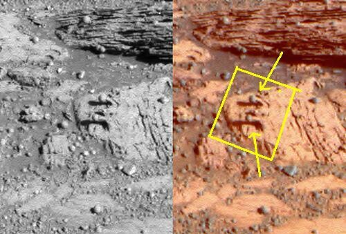
berry stem two honkers by dfrank39, on Flickr
Fossilized stemmed Berries.
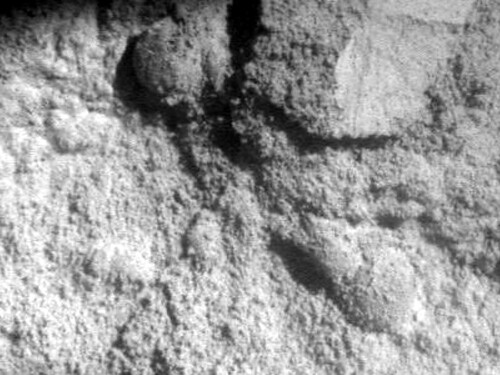
mama and papa by dfrank39, on Flickr
If you want a fossil hunters guide go here...
#95 Re: Unmanned probes » Mars Exploration Rovers (MER) » 2013-07-05 09:14:53
This is evident by the fact, that the only obvious water supply is at high levels buy polar water sublimation/evaporation and advective transport...
#96 Re: Unmanned probes » Mars Exploration Rovers (MER) » 2013-07-05 09:05:48
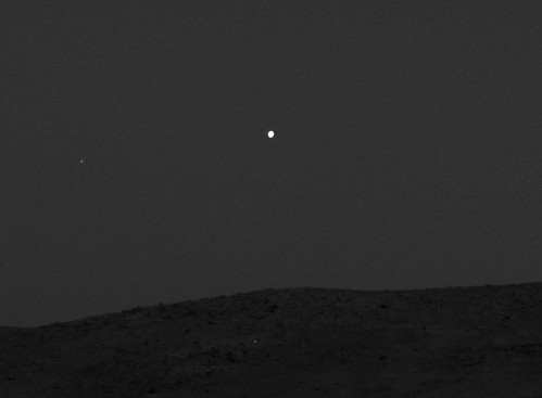
These are low level water ice clouds at sunrise over the current position of the Opportunity Rover. It was published by Hortonheardawho as a gift. You can go to his flickr site for the animation.
http://www.flickr.com/search/?q=hortonheardawho
How do we know they are water ice clouds. Temperatures here are above the condensation point of CO2, -135C at the poles. We know they are low level because of the size of the elements. These are stratiform , not cumuliform because of the lack of vertical development. In other words they were formed by cooling, not heating.
Saturation is known to occur at the surface via radiational cooling. Saturation aloft at low levels is possible only with a low level vapor supply. It has long been suspected that vapor geysers have been seen along the Meridiani Plan.....
Clouds:
http://www.flickr.com/photos/11627092@N06/9216883242/
Possible geyser locations:
#97 Re: Unmanned probes » Official MSL / Curiosity Rover Thread | Aug 5, 2012 10:31 p.m. PT » 2013-07-05 08:26:15
We always love to see the image. A link that works will do. First the new name for "true color" is "raw color." Who would have thunk it. Just load a camera on board and take the picture. It's not magic and not complicated and it aint red. I said that 30 years ago. I post a link below for those who were not born yet when the fight began.
Also we should talk about the apparent lack of visible fossils. More were seen along the track of Opportunity than here with Curiosity.
My theory goes like this. The window for development was small. I believe and propose that this area was hit by a large impact that destroyed any possibility of surface observation. Extreme heat and impact process compacted and or destroyed any fossils of complex development. This occurred near the end of Martian development. Any residual development was microscopic and can only be observed in this way.
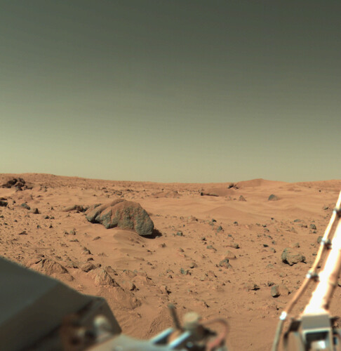
A link to the way we were told Mars looked like in 1976....