New Mars Forums
You are not logged in.
- Topics: Active | Unanswered
Announcement
#51 2005-05-28 07:21:11
- Palomar
- Member
- From: USA
- Registered: 2002-05-30
- Posts: 9,734
Re: Earth Atmospherics/Weather
*Hurricane gallery. Got the REAL gollywhoppers here:
http://www.livescience.com/php/multimed … ]Hurricane Elena
![http://www.livescience.com/php/multimed … ]Hurricane](http://www.livescience.com/php/multimedia/imagedisplay/img_display.php?pic=ig19_hurricanes_01_02.jpg&cap=Atlantic%20hurricane%20season%20runs%20June%201%20to%20Nov.%2030.%20...%20Hurricane%20Elena%2C%20with%20wind%20speeds%20in%20excess%20of%20110%20miles%20per%20hour%20%28177%20kilometers%20per%20hour%29%2C%20was%20photographed%20in%20the%20Gulf%20of%20Mexico%20on%20September%201%2C%201985.%20Almost%20the%20entire%20storm%20can%20be%20seen%20in%20this%20high-oblique%20photograph.%20For%20instance%2C%20a%20number%20of%20thunderstorms%20with%20their%20overshooting%20tops%2C%20the%20spiral%20bands%20of%20numerous%20thunderstorms%20leading%20to%20the%20eye%20of%20the%20hurricane%2C%20and%20numerous%20cloud%20gravity%20waves%20within%20the%20spiral%20bands%20can%20be%20seen.%20Some%20portions%20of%20the%20eye%20wall%2C%20where%20the%20most%20destructive%20winds%20of%20the%20storm%20occur%2C%20are%20also%20visible.%20This%20storm%20eventually%20made%20landfall%20near%20Gulfport%2C%20Mississippi.%20Click%20to%20enlarge.]Hurricane)
http://www.livescience.com/php/multimed … large.]Eye of Isabel
![http://www.livescience.com/php/multimed … large.]Eye](http://www.livescience.com/php/multimedia/imagedisplay/img_display.php?pic=ig19_hurricanes_02_02.jpg&cap=Astronaut%20Ed%20Lu%20snapped%20this%20photo%20of%20the%20eye%20of%20Hurricane%20Isabel%20from%20the%20International%20Space%20Station%20on%20September%2013%2C%202003%20at%2011%3A18%20UTC.%20At%20the%20time%2C%20Isabel%20was%20located%20about%20450%20miles%20northeast%20of%20Puerto%20Rico.%20It%20had%20dropped%20to%20a%20Category%204%20hurricane%20on%20the%20Saffir-Simpson%20Hurricane%20Scale%2C%20packing%20winds%20of%20150%20miles%20per%20hour%20with%20gusts%20up%20to%20184%20miles%20per%20hour.%20This%20photo%20shows%20the%20structure%20of%20Isabel%27s%20eyewall.%20What%20makes%20this%20photo%20unique%20is%20because%20no%20other%20sensor%20images%20the%20eyewalls%20of%20hurricane%20with%20such%20detail.%20Click%20to%20enlarge.]Eye)
http://www.livescience.com/php/multimed … ]Hurricane Andrew
![http://www.livescience.com/php/multimed … ]Hurricane](http://www.livescience.com/php/multimedia/imagedisplay/img_display.php?pic=ig19_hurricanes_04_02.jpg&cap=On%20the%20week%20of%20August%2024th%2C%201992%2C%20Atlantic-born%20Hurricane%20Andrew%20ripped%20through%20south%20Florida%2C%20barreled%20its%20way%20northwest%20across%20the%20Gulf%20of%20New%20Mexico%2C%20and%20slammed%20into%20Louisiana%20roughly%20one%20hundred%20miles%20southwest%20of%20New%20Orleans.%20Along%20the%20way%2C%20the%20Category%205%20hurricane%20gave%20rise%20to%2018-foot%20%285.5-meter%29%20storm%20surges%20that%20inundated%20coastal%20towns%20and%20maximum%20sustained%20winds%20of%20165%20miles%20%28266%20kilometer%29%20per%20hour%20that%20reduced%20entire%20neighborhoods%20to%20kindling.%20In%20the%20end%2C%20Andrew%20resulted%20in%20%2425%20billion%20in%20damages%20%281992%20dollars%29%20and%20more%20than%2060%20deaths%2C%20directly%20and%20indirectly%20through%20flooding.%20Click%20to%20enlarge.]Hurricane)
http://www.livescience.com/php/multimed … .]Remember this? Eye of Ivan. Looks truly sinister
![http://www.livescience.com/php/multimed … .]Remember](http://www.livescience.com/php/multimedia/imagedisplay/img_display.php?pic=ig19_hurricanes_05_02.jpg&cap=This%20image%20features%20the%20eye%20of%20Hurricane%20Ivan%20at%20center%2C%20partially%20framed%20by%20solar%20array%20panels%20on%20the%20International%20Space%20Station.%20One%20of%20the%20strongest%20hurricanes%20on%20record%2C%20Ivan%20was%20photographed%20on%20September%2011%2C%202004%20from%20an%20altitude%20of%20about%20230%20miles%20by%20Astronaut%20Edward%20M.%20%28Mike%29%20Fincke%2C%20NASA%20ISS%20science%20officer%20and%20flight%20engineer%2C%20aboard%20the%20orbital%20outpost.%20At%20the%20time%2C%20Ivan%20was%20in%20the%20western%20Caribbean%20Sea%20and%20reported%20to%20have%20winds%20of%20160%20mph.%20Click%20to%20enlarge.]Remember)
http://www.livescience.com/php/multimed … imensional Hurricane Diana
http://www.livescience.com/php/multimed … pectacular Eye & Wall (which storm not ID'd)
--Cindy
We all know [i]those[/i] Venusians: Doing their hair in shock waves, smoking electrical coronas, wearing Van Allen belts and resting their tiny elbows on a Geiger counter...
--John Sladek (The New Apocrypha)
Offline
Like button can go here
#52 2005-05-28 07:38:45
- Shaun Barrett
- Member
- From: Cairns, Queensland, Australia
- Registered: 2001-12-28
- Posts: 2,843
Re: Earth Atmospherics/Weather
Yep!
Those cyclone pictures really bring home to you the awesome power of nature - and its sinister side.
So beautiful ... so mindlessly destructive. ![]()
The word 'aerobics' came about when the gym instructors got together and said: If we're going to charge $10 an hour, we can't call it Jumping Up and Down. - Rita Rudner
Offline
Like button can go here
#53 2005-05-29 01:03:31
- Weave
- Banned
- From: Albuquerque, New Mexico, USA
- Registered: 2005-05-08
- Posts: 14
Re: Earth Atmospherics/Weather
You know your going to have a bad day when you have to scrape the ice off your windshield these days.
[img]mailhtml:mid://00000000/!http://www.sunbelt-software.com/stu/ice1.jpg[/img]
Weave
[size=18:sig_uid]WEAVE[/size:sig_uid]
Offline
Like button can go here
#54 2005-05-31 04:46:30
- Palomar
- Member
- From: USA
- Registered: 2002-05-30
- Posts: 9,734
Re: Earth Atmospherics/Weather
*Hi Weave: True.
Hi Shaun: If you liked those, just wait for the tornado pics...
On a different note:
http://www.spaceweather.com/swpod2005/3 … ye.jpg]Red rainbow
![http://www.spaceweather.com/swpod2005/3 … ye.jpg]Red](http://www.spaceweather.com/swpod2005/30may05/zhu_eye.jpg]Red)
Okaaaay. :-\ That's a first (for me). Caused by sunset light.
the towering rainbow Jerry Xiaojin Zhu photographed from Pittsburgh on May 28th, at sunset, was simply red...
"Sunset rainbows ride high in the sky because their centers are exactly opposite the sun. Like a see-saw, the lower the sun, the higher is the bow," explains atmospheric optics expert Les Cowley. "Sunset light making up the 'bow is highly reddened by its long travel through the lower atmosphere where air and dust preferentially scatter away blues and greens. Jerry's 'bow shows something more, that rainbows are disks with colored rims. When you next see a bow, look for the contrast between the bright sky inside and the dark of Alexanders dark band immediately outside."
Hosted by spaceweather.com. I've seen my share of rainbows/storm breaks close to sunset, but never anything like that. ::shrugs::
--Cindy
We all know [i]those[/i] Venusians: Doing their hair in shock waves, smoking electrical coronas, wearing Van Allen belts and resting their tiny elbows on a Geiger counter...
--John Sladek (The New Apocrypha)
Offline
Like button can go here
#55 2005-06-02 10:42:12
- Palomar
- Member
- From: USA
- Registered: 2002-05-30
- Posts: 9,734
Re: Earth Atmospherics/Weather
*Tornado gallery:
http://www.livescience.com/php/multimed … ge.]Making contact with ground
![http://www.livescience.com/php/multimed … ge.]Making](http://www.livescience.com/php/multimedia/imagedisplay/img_display.php?pic=ig12_tornado_04_02.jpg&cap=A%20powerful%20tornado%20makes%20its%20way%20on%20the%20land.%20%20Interestingly%20enough%2C%20%93in%20order%20for%20a%20vortex%20to%20be%20classified%20as%20a%20tornado%2C%20it%20must%20be%20in%20contact%20with%20the%20ground%20and%20the%20cloud%20base.%94%20Click%20to%20enlarge.]Making)
-*-
A classic tornado photo:
http://www.livescience.com/php/multimed … rge.]Rated F4
![http://www.livescience.com/php/multimed … rge.]Rated](http://www.livescience.com/php/multimedia/imagedisplay/img_display.php?pic=ig12_tornado_05_02.jpg&cap=This%20tornado%2C%20rated%20F4%2C%20developed%20during%20the%20afternoon%20of%20April%2027%2C%201984%2C%20killing%20one%20person%2C%20and%20injuring%2014%20in%20Waukesha%20County.%20The%20tornado%20was%20one%20of%20several%20in%20the%20state%20that%20developed%20ahead%20of%20a%20strong%20cold%20front.%20Click%20to%20enlarge.]Rated)
-*-
http://www.livescience.com/php/multimed … e.]Ghostly finger
![http://www.livescience.com/php/multimed … e.]Ghostly](http://www.livescience.com/php/multimedia/imagedisplay/img_display.php?pic=ig12_tornado_06_02.jpg&cap=A%20long%20spiral%20tornado%20approaches%20Union%20City%2C%20OK.%20Click%20to%20enlarge.]Ghostly)
-*-
![Textbook]http://www.livescience.com/php/multimedia/imagedisplay/img_display.php?pic=ig12_tornado_07_02.jpg&cap=Alfalfa%20OK%2C%2022%20May%201981%2C%20looking%20NNW.%20A%20%22textbook%22%20tornado%20extending%20from%20the%20wall%20cloud%20of%20a%20classic%20supercell%2C%20with%20a%20%22clear%20slot%22%20cutting%20through%20the%20cloud%20base%20around%20the%20near%20side%20of%20the%20wall%20cloud.%20The%20slot%20represents%20part%20of%20the%20occlusion%20downdraft%2C%20an%20arc%20of%20sinking%20air%20believed%20to%20contribute%20to%20tornado%20development%20in%20many%20cases.%20The%20tornado%20did%20damage%20rated%20at%20F2.%20Click%20to%20enlarge.]"Textbook"](http://www.livescience.com/php/multimedia/imagedisplay/img_display.php?pic=ig12_tornado_07_02.jpg&cap=Alfalfa%20OK%2C%2022%20May%201981%2C%20looking%20NNW.%20A%20%22textbook%22%20tornado%20extending%20from%20the%20wall%20cloud%20of%20a%20classic%20supercell%2C%20with%20a%20%22clear%20slot%22%20cutting%20through%20the%20cloud%20base%20around%20the%20near%20side%20of%20the%20wall%20cloud.%20The%20slot%20represents%20part%20of%20the%20occlusion%20downdraft%2C%20an%20arc%20of%20sinking%20air%20believed%20to%20contribute%20to%20tornado%20development%20in%20many%20cases.%20The%20tornado%20did%20damage%20rated%20at%20F2.%20Click%20to%20enlarge.)
-*-
http://www.livescience.com/php/multimed … arge.]Wide tornado & streaking hailstone
![http://www.livescience.com/php/multimed … arge.]Wide](http://www.livescience.com/php/multimedia/imagedisplay/img_display.php?pic=ig12_tornado_09_02.jpg&cap=Mayfield%20OK%2C%2016%20May%201977%2C%20looking%20N.%20Large%20tornado%2C%20which%20produced%20F2%20damage%20to%20homes%2C%20and%20also%20destroyed%20two%20trailers%20and%20a%20few%20barns.%20The%20white%20streak%20at%20upper%20left%20is%20a%20falling%20hailstone.%20This%20was%20part%20of%20one%20of%20the%20most%20active%20storm%20intercept%20weeks%20ever%20seen%20in%20Oklahoma%20and%20the%20Texas%20Panhandle%20--%20the%20legendary%20%22Seven%20Days%20of%20May%22%20in%201977.%20Click%20to%20enlarge.]Wide)
-*-
http://www.livescience.com/php/multimed … e.]Eeeeeek! ![]()
![http://www.livescience.com/php/multimed … e.]Eeeeeek](http://www.livescience.com/php/multimedia/imagedisplay/img_display.php?pic=ig12_tornado_10_02.jpg&cap=Tornado%20captured%20during%20NOAA%20Project%20Vortex.%20%20The%20photo%20was%20taken%20south%20of%20Dimmit%2C%20Texas%2C%20in%20June%201995.%20Click%20to%20enlarge.]Eeeeeek)
I honestly don't know how anyone can stand there with a camera and take a steady shot. My arms would be trembling so bad. ![]() I wouldn't even be standing there...it's too close.
I wouldn't even be standing there...it's too close.
Anyway, looks like a much smaller funnel cloud might be forming off to its right.
-*-
http://www.livescience.com/php/multimed … e.]Classic "carrot."
![http://www.livescience.com/php/multimed … e.]Classic](http://www.livescience.com/php/multimedia/imagedisplay/img_display.php?pic=ig12_tornado_11_02.jpg&cap=A%20large%20tornado%20builds%20up%20steam%20and%20storms%20straight%20forward.%20Click%20to%20enlarge.]Classic)
-*-
http://www.livescience.com/php/multimed … arge.]Wavy tornado
![http://www.livescience.com/php/multimed … arge.]Wavy](http://www.livescience.com/php/multimedia/imagedisplay/img_display.php?pic=ig12_tornado_12_02.jpg&cap=Tornadoes%20are%20low%20pressure%20systems%2C%20and%20can%20generate%20wind%20velocities%20that%20can%20exceed%20200%20mph.%20Severe%20ones%20will%20flatten%20buildings%20%28tornadoes%20have%20a%20special%20fondness%20for%20trailer%20parks%29%2C%20uproot%20trees%2C%20and%20carry%20objects%20for%20hundreds%20of%20feet%20to%20even%20miles%20from%20their%20spot%20of%20origin.%20On%20May%2027%2C%201997%20several%20lines%20of%20storm%20clouds%20bearing%20multiple%20funnel%20clouds%20crossed%20central%20Texas%20with%20deadly%20results.%20Here%20is%20a%20GOES-8%20image%20of%20these%20advancing%20fronts.%20Click%20to%20enlarge.]Wavy)
-*-
http://www.livescience.com/php/multimed … e.]Tornado develops almost directly overhead
![http://www.livescience.com/php/multimed … e.]Tornado](http://www.livescience.com/php/multimedia/imagedisplay/img_display.php?pic=ig12_tornado_15_02.jpg&cap=El%20Reno%20OK%2C%2030%20April%201978%2C%20looking%20W.%20This%20photo%20was%20shot%20from%20the%20back%20of%20a%20storm%20intercept%20vehicle%20while%20fleeing%20a%20tornado%2C%20which%20developed%20almost%20directly%20overhead.%20In%20other%20words%2C%20the%20chasers%20became%20the%20chased.%20The%20tornado%20touched%20down%20on%20a%20small%20house%20a%20few%20hundred%20feet%20away%2C%20pulling%20its%20roof%20off%20and%20scattering%20all%20manner%20of%20boards%2C%20shingles%20and%20other%20debris%20through%20the%20air.%20Click%20to%20enlarge.]Tornado)
Those storm chasers got an unpleasant surprise. :-\
-*-
http://www.livescience.com/php/multimed … arge.]This photo is SO creepy
![http://www.livescience.com/php/multimed … arge.]This](http://www.livescience.com/php/multimedia/imagedisplay/img_display.php?pic=ig12_tornado_16_02.jpg&cap=Shown%20above%20is%20the%20oldest%20known%20photograph%20of%20a%20tornado%20taken%20near%20Howard%2C%20South%20Dakota%2C%20on%20August%2028%2C%201884.%20Click%20to%20enlarge.]This)
They truly saved the best for last. Of course the photo was in black & white...which lends to the gruesome appearance. It looks truly evil. :-\
I recall reading about the "plagues" of tornados in the Dakotas (South Dakota especially) in the 1880s. People out in the countryside (what else), riding along in their horse-drawn buggies and a nasty storm would brew up. Sometimes having to try and outrun a twister, the horses nearly dying of fright, etc.
--Cindy
We all know [i]those[/i] Venusians: Doing their hair in shock waves, smoking electrical coronas, wearing Van Allen belts and resting their tiny elbows on a Geiger counter...
--John Sladek (The New Apocrypha)
Offline
Like button can go here
#56 2005-06-03 09:31:23
- Palomar
- Member
- From: USA
- Registered: 2002-05-30
- Posts: 9,734
Re: Earth Atmospherics/Weather
http://www.livescience.com/forcesofnatu … html]Storm chasers cast new eye on tornadoes
*Will opt for mostly copy and paste, as I'm currently pressed for time:
Rapid scanning radar, which is being used in the field for the first time this season, improves the efficiency of tornado imaging considerably, building a "layer cake" of tornado images in a matter of seconds.
"With rapid scanning radar we can rake the sky with six beams simultaneously," tornado expert Joshua Wurman told LiveScience. "We need 10 to 15 2-D images to create one 3-D image, and we can do that every 5 to 10 seconds"
Mentions "Doppler on Wheels." They try to get 3 - 5 miles ahead of the tornado. The closer the better, and they seem to aim for photos from 1 mile away.
A tornado changes dramatically as it churns....
"It’s very important to get images of tornadoes very rapidly," said Wurman..."If there’s too much time in between images, we can’t tell how it got from point A to point B."
Particular concern focuses on F4 and F5 tornadoes. They admit they can't predict which storms will and will not produce tornadoes.
2005 tornado season has been slow (and so it seems, based on other reporting -- or rather, NONreporting -- I've been keeping tabs on); tornadoes occurring at only half the normal rate.
--Cindy
P.S.: I'd like to get in on some of those storm chases. ![]()
We all know [i]those[/i] Venusians: Doing their hair in shock waves, smoking electrical coronas, wearing Van Allen belts and resting their tiny elbows on a Geiger counter...
--John Sladek (The New Apocrypha)
Offline
Like button can go here
#57 2005-06-08 12:04:41
- Palomar
- Member
- From: USA
- Registered: 2002-05-30
- Posts: 9,734
Re: Earth Atmospherics/Weather
http://news.yahoo.com/s/ap/20050608/ap_ … Upper-tier states get pummeled by storms. :-\
*Hardest-hit seems to be South Dakota. Flooding; a small-town city hall in South Dakota completely flattened; wind gusts up to 92 mph; tornado reported in SD; hailstones 3 inches in diameter reported in Meade County, SD.
Minnesota, Iowa and western Wisconsin got hit too. Tornado reported in Wisconsin.
--Cindy
We all know [i]those[/i] Venusians: Doing their hair in shock waves, smoking electrical coronas, wearing Van Allen belts and resting their tiny elbows on a Geiger counter...
--John Sladek (The New Apocrypha)
Offline
Like button can go here
#58 2005-06-09 11:58:34
- Palomar
- Member
- From: USA
- Registered: 2002-05-30
- Posts: 9,734
Re: Earth Atmospherics/Weather
http://www.livescience.com/forcesofnatu … l]Tropical Storm Arlene
*First of the season (which officially began June 1).
Warnings out for parts of Cuba. Arlene is already releasing heavy rains and the edges of its clouds are already sweeping over Florida. They're predicting landfall this weekend, somewhere between Florida and Lousiana. Is not expected to developed into a hurricane, however. Was officially named this morning and currently packs 40-mph winds.
Includes projected path map.
--Cindy
We all know [i]those[/i] Venusians: Doing their hair in shock waves, smoking electrical coronas, wearing Van Allen belts and resting their tiny elbows on a Geiger counter...
--John Sladek (The New Apocrypha)
Offline
Like button can go here
#59 2005-06-10 12:11:00
- Palomar
- Member
- From: USA
- Registered: 2002-05-30
- Posts: 9,734
Re: Earth Atmospherics/Weather
http://news.yahoo.com/s/ap/20050610/ap_ … l]Tropical Storm Arlene strengthens
*Drenches Cuba, moves towards U.S. Gulf Coast. Winds are up to 60 mph from 45 mph yesterday. They're predicting TS Arlene might become a weak hurricane tomorrow, just prior to landfall; hurricane watches have been posted.
--Cindy
We all know [i]those[/i] Venusians: Doing their hair in shock waves, smoking electrical coronas, wearing Van Allen belts and resting their tiny elbows on a Geiger counter...
--John Sladek (The New Apocrypha)
Offline
Like button can go here
#60 2005-06-13 07:47:24
- Palomar
- Member
- From: USA
- Registered: 2002-05-30
- Posts: 9,734
Re: Earth Atmospherics/Weather
http://antwrp.gsfc.nasa.gov/apod/image/ … jpg]Beauty & the Beast
![http://antwrp.gsfc.nasa.gov/apod/image/ … jpg]Beauty](http://antwrp.gsfc.nasa.gov/apod/image/0506/tornado_nguyen_big.jpg]Beauty)
*What a striking photo. And the line of dark host cloud, the way it appears angled to the left of the tornado, certainly lends to the overall "effect." And yes, it does seem the tornado is touching the rainbow.
This is being hosted by Astropix.
Here's the caption:
Explanation: The scene might have been considered serene if it weren't for the tornado. Last June in Kansas, storm chaser Eric Nguyen photographed this budding twister in a different light -- the light of a rainbow. Pictured above, a white tornado cloud descends from a dark storm cloud. The Sun, peaking through a clear patch of sky to the left, illuminates some buildings in the foreground. Sunlight reflects off raindrops to form a rainbow. By coincidence, the tornado appears to end right over the rainbow. Streaks in the image are hail being swept about by the high swirling winds.
Those whitish tornadoes are often the eeriest looking, IMO. ::shrugs::
--Cindy
We all know [i]those[/i] Venusians: Doing their hair in shock waves, smoking electrical coronas, wearing Van Allen belts and resting their tiny elbows on a Geiger counter...
--John Sladek (The New Apocrypha)
Offline
Like button can go here
#61 2005-06-15 08:04:27
- Palomar
- Member
- From: USA
- Registered: 2002-05-30
- Posts: 9,734
Re: Earth Atmospherics/Weather
http://www.spaceweather.com/swpod2005/1 … ms.jpg]May 25, Scotland
![http://www.spaceweather.com/swpod2005/1 … ms.jpg]May](http://www.spaceweather.com/swpod2005/15jun05/williams.jpg]May)
*Brocken Spectre. A guy named Ronnie Wilson took this photo; it's being hosted at spaceweather.com. Is one of the best "Spectre" photos I've seen. Was taken on the Aonoch Eagach mountain ridge -- western Scotland.
Atmospheric optics expert Les Cowley explains: "Sunshine through mountain mist has created two effects, one from shadows and the other by a mysterious wave process inside the mist droplets. The highly distorted shadow is the famous 'Brocken Spectre.' It is your shadow stretching away through the mist towards a point directly opposite the sun. The colored rings are a 'Glory' produced when minuscule fog droplets diffract and somehow aided by surface waves reflect sunlight directly backwards.
--Cindy
We all know [i]those[/i] Venusians: Doing their hair in shock waves, smoking electrical coronas, wearing Van Allen belts and resting their tiny elbows on a Geiger counter...
--John Sladek (The New Apocrypha)
Offline
Like button can go here
#62 2005-06-17 04:57:01
- Palomar
- Member
- From: USA
- Registered: 2002-05-30
- Posts: 9,734
Re: Earth Atmospherics/Weather
http://www.spaceweather.com/nlcs/galler … octilucent Cloud Gallery
*A collection from spaceweather.com. These clouds mostly occur over extremely cold regions. I'm too far south to see them.
Speculation is they occur due to space dust or perhaps even a byproduct of global warming.
--Cindy
We all know [i]those[/i] Venusians: Doing their hair in shock waves, smoking electrical coronas, wearing Van Allen belts and resting their tiny elbows on a Geiger counter...
--John Sladek (The New Apocrypha)
Offline
Like button can go here
#63 2005-06-20 10:06:10
- Palomar
- Member
- From: USA
- Registered: 2002-05-30
- Posts: 9,734
Re: Earth Atmospherics/Weather
http://www.spaceweather.com/nlcs/galler … octilucent Cloud Gallery
*A collection from spaceweather.com. These clouds mostly occur over extremely cold regions. I'm too far south to see them.
Speculation is they occur due to space dust or perhaps even a byproduct of global warming.
--Cindy
http://antwrp.gsfc.nasa.gov/apod/ap050619.html]This Astropix article
*...gives yet another speculation as to the origins of noctilucent clouds. Freezing water exhaust from Soyuz maybe, but not the other (hasn't flown in a few years and these clouds are still being seen and photographed).
I'm surprised the APOD editors would miss that little factoid. :-\
--Cindy
We all know [i]those[/i] Venusians: Doing their hair in shock waves, smoking electrical coronas, wearing Van Allen belts and resting their tiny elbows on a Geiger counter...
--John Sladek (The New Apocrypha)
Offline
Like button can go here
#64 2005-06-21 07:36:59
- Palomar
- Member
- From: USA
- Registered: 2002-05-30
- Posts: 9,734
Re: Earth Atmospherics/Weather
http://www.spaceweather.com/swpod2005/2 … g]Midnight Sun over Finland
![http://www.spaceweather.com/swpod2005/2 … g]Midnight](http://www.spaceweather.com/swpod2005/21jun05/Rahtu1.jpg]Midnight)
*And of course today is summer solstice for us folks in the northern hemisphere. There's an optical illusion in this photo, which is primarily why I'm posting it:
Rovaniemi is 7 kilometers south of the Arctic Circle, which means, strictly speaking, the midnight sun ought to dip below the horizon. What's going on? "The sun can be seen here because sunbeams are bent by the atmosphere," explains Rahtu (photographer).
It sure doesn't look that way. :;): I've never been in an area of the world which experiences "the Midnight Sun"; would certainly be odd.
Photo and info hosted by spaceweather.com.
--Cindy
We all know [i]those[/i] Venusians: Doing their hair in shock waves, smoking electrical coronas, wearing Van Allen belts and resting their tiny elbows on a Geiger counter...
--John Sladek (The New Apocrypha)
Offline
Like button can go here
#65 2005-06-26 21:22:32
- Palomar
- Member
- From: USA
- Registered: 2002-05-30
- Posts: 9,734
Re: Earth Atmospherics/Weather
http://www.spaceweather.com/nlcs/galler … octilucent Cloud Gallery
*A collection from spaceweather.com. These clouds mostly occur over extremely cold regions. I'm too far south to see them.
*An 8-minute compressed-time movie of noctilucent cloud motions:
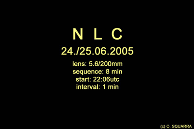
This is from over the Baltic Sea, June 24th. Hosted by spaceweather.com. Their movements are described as rippling and moving like ocean waves.
Noctilucent clouds (NLCs) are a mystery. They hover near the edge of space, far above ordinary clouds.
I'm too far south to likely ever see them, so I especially appreciate that video clip. :up:
--Cindy
We all know [i]those[/i] Venusians: Doing their hair in shock waves, smoking electrical coronas, wearing Van Allen belts and resting their tiny elbows on a Geiger counter...
--John Sladek (The New Apocrypha)
Offline
Like button can go here
#66 2005-07-05 15:16:44
- Palomar
- Member
- From: USA
- Registered: 2002-05-30
- Posts: 9,734
Re: Earth Atmospherics/Weather
http://news.yahoo.com/s/ap/20050705/ap_ … 6]Tropical Storms Cindy, Dennis & Dora
*Current sustained winds of 60, 40 and 40 mph respectively. Cindy may increase in strength, but it's doubtful will become a hurricane. As of 2:00 p.m. EDT TS Cindy was aprox 125 miles SW of Louisiana's ocean coast, moving aprox 14 mph to the north; is expected to move NE. Chances of heavy rainfalls extending for up to 105 miles east of storm's center.
Dennis is aprox 335 miles S-SE of San Juan, Puerto Rico.
Ah...Dora is in the Pacific, along Mexico's SW coast. Not expected to strengthen much either. Sometimes we get the rainfalls from storms like Dora, as they dissipate of course. Though usually they're larger than what Dora seems to currently be.
--Cindy
We all know [i]those[/i] Venusians: Doing their hair in shock waves, smoking electrical coronas, wearing Van Allen belts and resting their tiny elbows on a Geiger counter...
--John Sladek (The New Apocrypha)
Offline
Like button can go here
#67 2005-07-06 05:25:33
- Palomar
- Member
- From: USA
- Registered: 2002-05-30
- Posts: 9,734
Re: Earth Atmospherics/Weather
http://news.yahoo.com/s/ap/20050706/ap_ … Y-]Updates on TS Cindy & Dennis
*Apparently birds in the area of Louisiana haven't suddenly vanished in droves, so the TS pressure isn't dropping. LA shores have had heavy winds/rains from TS Cindy, perhaps up to 10 inches of rain possible. Folks in low-lying areas have been notified they may need to evacuate because of flooding potential. TS Cindy maximum wind 70 mph, but today will probably drop to 60 mph.
TS Dennis still "brewing" in the Caribbean. Anticipated it'll arrive in the Gulf this weekend. TS Dennis currently traveling aprox 16 mph, W - NW.
--Cindy
We all know [i]those[/i] Venusians: Doing their hair in shock waves, smoking electrical coronas, wearing Van Allen belts and resting their tiny elbows on a Geiger counter...
--John Sladek (The New Apocrypha)
Offline
Like button can go here
#68 2005-07-06 07:07:30
- Palomar
- Member
- From: USA
- Registered: 2002-05-30
- Posts: 9,734
Re: Earth Atmospherics/Weather
http://www.livescience.com/forcesofnatu … ths.html]A record for tornado season
*No deaths from tornadoes for April through June of this year. That's a record since official record-keeping began in 1950. Another record year was 1992: Only 1 tornado-related death reported. Average number of deaths from Spring tornadoes is 52.
There have been a normal number of twisters this year, but they haven't remained on the ground as long as they generally do. :hm: Meterologists calling this a "unique situation":
The ingredients needed in the atmosphere never really came together, preventing development of our normal springtime pattern that makes long-track tornadoes
Not out of the woods yet, though, due to the tropical season starting. Last year 300 tornadoes were spawned from tropical storms and hurricanes. Yipes. But the April - June record stands. That's good to know.
--Cindy
P.S.: Article also includes "Tornado Trivia." I wonder how many tornadoes -- percentage wise -- merely stand still and grind away at one spot versus their mobile counterparts.
We all know [i]those[/i] Venusians: Doing their hair in shock waves, smoking electrical coronas, wearing Van Allen belts and resting their tiny elbows on a Geiger counter...
--John Sladek (The New Apocrypha)
Offline
Like button can go here
#69 2005-07-06 13:56:38
- Palomar
- Member
- From: USA
- Registered: 2002-05-30
- Posts: 9,734
Re: Earth Atmospherics/Weather
http://www.space.com/scienceastronomy/0 … s.html]Yet another article about noctilucent clouds...
*...with speculation (throughout the article) that they are a result of shuttle exhaust/plumes. Cites example over South Pole just prior to Columbia disaster.
Well...all shuttle flights have been grounded for over 2 years now and yet sightings and photographs of noctilucent clouds continue. (Post dated June 26)
Am I the only person seeing the trouble with that theory?
Unless another type of rocket (Soyuz) exhaust could be the culprit.
These clouds are the highest known, averaging 52 miles above the Earth.
Refer to post of June 20, and hyperlink to APOD article.
Other rocket launches inject water into the atmosphere, but none so much as the shuttle launch vehicles.
Yeah, but the shuttle hasn't been launched/flying in over 2 years and the noctilucent clouds keep forming and being photographed. Hello?
--Cindy
We all know [i]those[/i] Venusians: Doing their hair in shock waves, smoking electrical coronas, wearing Van Allen belts and resting their tiny elbows on a Geiger counter...
--John Sladek (The New Apocrypha)
Offline
Like button can go here
#70 2005-07-07 05:15:20
- Palomar
- Member
- From: USA
- Registered: 2002-05-30
- Posts: 9,734
Re: Earth Atmospherics/Weather
Its]http://news.yahoo.com/news?tmpl=story&u=/ap/20050707/ap_on_re_la_am_ca/hurricane_dennis]It's *Hurricane* Dennis now
*Whoa. Many inches of rain on Haiti, is likely to strike Jamaica next. Winds expected to strengthen before landfall. Hurricane warnings posted for Cuba -- including Gitmo of course.
Mentions the impact of these tropical storms and hurricanes on oil production/refining in the Gulf, and how prices will likely rise as a result.
--Cindy
We all know [i]those[/i] Venusians: Doing their hair in shock waves, smoking electrical coronas, wearing Van Allen belts and resting their tiny elbows on a Geiger counter...
--John Sladek (The New Apocrypha)
Offline
Like button can go here
#71 2005-07-08 06:24:21
- Palomar
- Member
- From: USA
- Registered: 2002-05-30
- Posts: 9,734
Re: Earth Atmospherics/Weather
http://news.yahoo.com/news?tmpl=story&u … ]Hurricane Dennis reaches wind speeds of 135 mph
*Wowie. It went from ho-hum tropical storm to hurricane with a vengeance. :-\ Is currently a Category 4 (5 is the highest on the scale). Five unfortunate folks dead in Haiti. Dennis moving NW @ 15 mph (seems a bit slow?). The eye of the storm is expected to pass over central Cuba this evening. Dennis should reach U.S. Gulf Coast Sunday. Florida Keys residents told to evacuate.
--Cindy
::EDIT:: 4 hours later:
http://news.yahoo.com/s/ap/20050708/ap_ … CUl]Dennis reaches wind speeds of 150 mph
Hurricane-force winds exceed 50 miles out from the storm; tropical-storm force winds 160 miles out.
We all know [i]those[/i] Venusians: Doing their hair in shock waves, smoking electrical coronas, wearing Van Allen belts and resting their tiny elbows on a Geiger counter...
--John Sladek (The New Apocrypha)
Offline
Like button can go here
#72 2005-07-11 07:28:41
- Palomar
- Member
- From: USA
- Registered: 2002-05-30
- Posts: 9,734
Re: Earth Atmospherics/Weather
http://www.spacedaily.com/news/hurricane-05c.html]A 3D look at the insides of hurricanes
*NASA can get this data within 3 hours -- a big boost for meterologists. Involves TRMM satellite. Interesting about "hot towers":
Higher hot towers around the eye usually indicate a strengthening storm.
The snapshot also gives valuable information about how the storm is put together. For example, when scientists studying a snapshot see that the body of the hurricane may be tilted inward to the hot towers, it could give clues as to whether a wind shear, or a sudden change in direction of winds near the top of the storm, may impact the storm's strength. Normally, when a hurricane runs into a strong wind shear, it weakens.
Importance of rainfall pattern/concentration:
TRMM is a unique satellite that is able to estimate rainfall measurements from space, and rainfall is a key ingredient in hurricanes. For example, heaviest concentrations of rainfall for example are found around the eye or center of the hurricane. Scientists can tell, based on if the rain is getting stronger or weaker, whether or not the hurricane is strengthening or weakening.
--Cindy
We all know [i]those[/i] Venusians: Doing their hair in shock waves, smoking electrical coronas, wearing Van Allen belts and resting their tiny elbows on a Geiger counter...
--John Sladek (The New Apocrypha)
Offline
Like button can go here
#73 2005-07-12 12:23:11
- Palomar
- Member
- From: USA
- Registered: 2002-05-30
- Posts: 9,734
Re: Earth Atmospherics/Weather
http://news.yahoo.com/s/ap/20050712/ap_ … PUCUl]Here comes Tropical Storm Emily
*Developed into a TS late Monday. Her traveling speed has picked up by 6 mph; currently traveling @ 15 mph. Maximum wind strength currently 50 mph. Hurricane watches posted for Caribbean islands. Hurricane-force winds might be felt by some of the islands late Wednesday or early Thursday.
Emily is projected to be near Puerto Rico on Friday and might approach U.S. mainland next week.
Check out last sentence too.
Looks like a brisk season underway.
--Cindy
We all know [i]those[/i] Venusians: Doing their hair in shock waves, smoking electrical coronas, wearing Van Allen belts and resting their tiny elbows on a Geiger counter...
--John Sladek (The New Apocrypha)
Offline
Like button can go here
#74 2005-07-13 05:18:29
- Palomar
- Member
- From: USA
- Registered: 2002-05-30
- Posts: 9,734
Re: Earth Atmospherics/Weather
http://antwrp.gsfc.nasa.gov/apod/image/ … pg]Strange photo
![http://antwrp.gsfc.nasa.gov/apod/image/ … pg]Strange](http://antwrp.gsfc.nasa.gov/apod/image/0507/kilimanjaro_hogen_big.jpg]Strange)
*It certainly looks like there's a massive fire beneath those clouds. :-\
A group hiking at 6 am near the top of Mt. Kilimanjaro watched the rising sun peak above the clouds and the horizon light up red. Don't worry -- in this case the highest volcano in Africa is not even erupting. The spectacular sunrise colors are caused by light scattering off the atmosphere and small cloud particles. If all of the scattered light that makes the sky blue were added back into the scene, the sunrise would appear Sun-colored and not so red. A similar light scattering effect involving small airborne dust particles causes sunsets on Mars to be red
Amazing. I've not seen a photo like this before.
[Info and pic from Astronomy Picture of the Day]
--Cindy
We all know [i]those[/i] Venusians: Doing their hair in shock waves, smoking electrical coronas, wearing Van Allen belts and resting their tiny elbows on a Geiger counter...
--John Sladek (The New Apocrypha)
Offline
Like button can go here
#75 2005-07-13 10:38:50
- Palomar
- Member
- From: USA
- Registered: 2002-05-30
- Posts: 9,734
Re: Earth Atmospherics/Weather
http://news.yahoo.com/s/ap/20050712/ap_ … PUCUl]Here comes Tropical Storm Emily
*Developed into a TS late Monday. Her traveling speed has picked up by 6 mph; currently traveling @ 15 mph. Maximum wind strength currently 50 mph. Hurricane watches posted for Caribbean islands. Hurricane-force winds might be felt by some of the islands late Wednesday or early Thursday.
Emily is projected to be near Puerto Rico on Friday and might approach U.S. mainland next week.
http://news.yahoo.com/s/ap/20050713/ap_ … her]Update on TS Emily
*Barbados gov't orders businesses across the island to close. Hurricane watch initially posted by Barbados gov't, though it's been downgraded to TS watch. Odd, considering Emily is still expected to strengthen into a hurricane. Hmmmmm.
As of 11 a.m. EST, Emily was 165 miles SE of Barbados, carrying maximum sustained winds of 60 mph and traveling at 20 mph.
--Cindy
We all know [i]those[/i] Venusians: Doing their hair in shock waves, smoking electrical coronas, wearing Van Allen belts and resting their tiny elbows on a Geiger counter...
--John Sladek (The New Apocrypha)
Offline
Like button can go here